Unified GIS
100% Open Geospatial Consortium (OGC) compliant and follow the standard data types.
Vector formats
Our software support the following vector formats
- Comma separated values (csv – generic and customised)
- Keyhole Markup Language (KML)
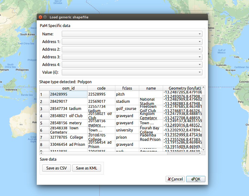
- Shapefiles (SHP)
Raster formats
- GeoTIFF
- Bitmap, png and jpeg
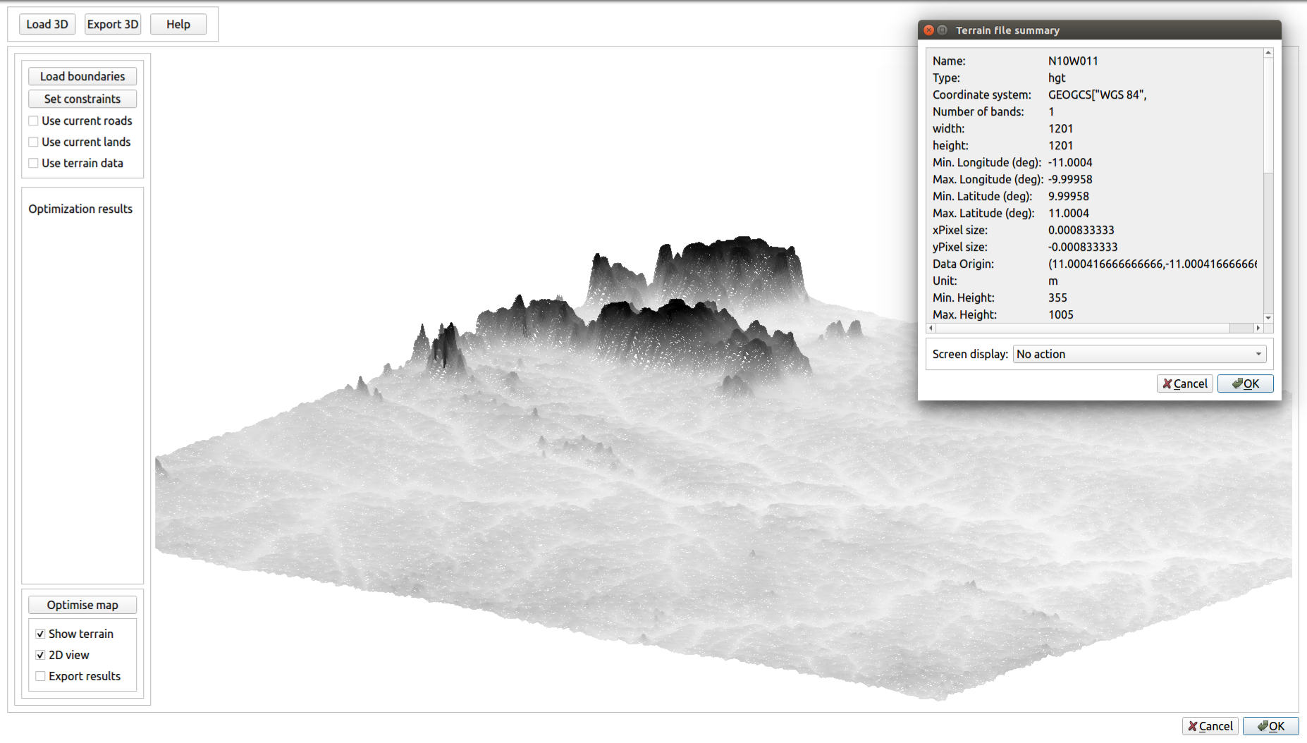
- Shuttle Radar Topography Mission – SRTM (.hgt)
- United States Geological Survey’s ArcGrid binary (.adf)
- United States Digital Elevation Model (.dem)
- Erdas Imagine (.img)
Geospatial databases
PaM Desktop software support the following databases with geospatial extensions that conform to the Open Geospatial Consortium (OGC) standards
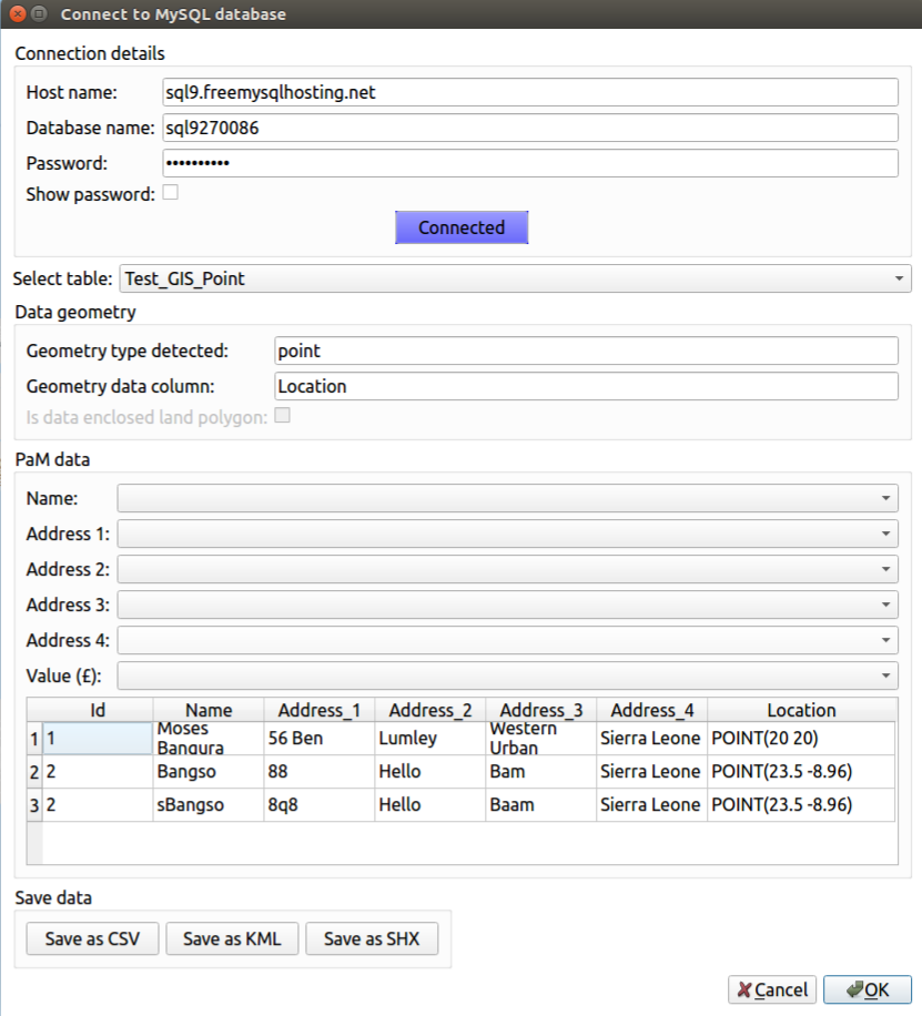
- MySQL
- PostGIS
- SpatiaLite