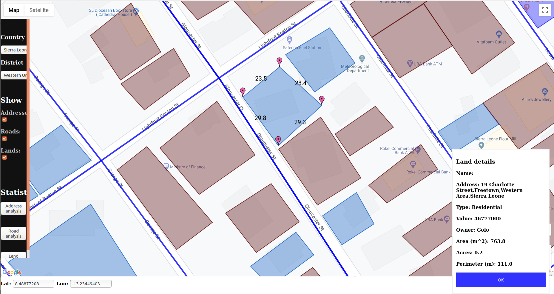
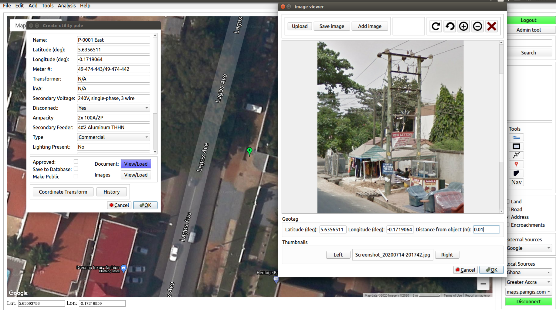
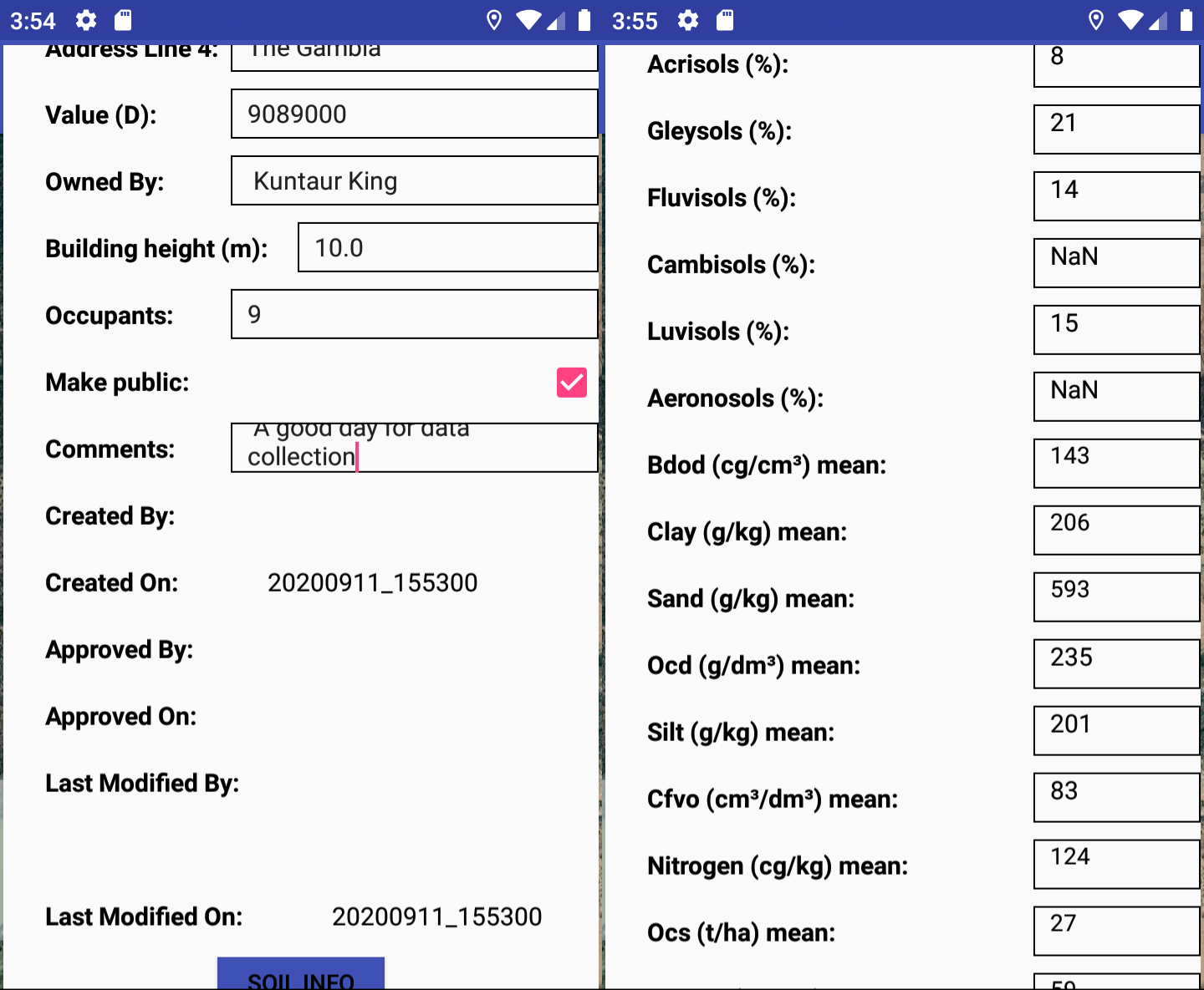
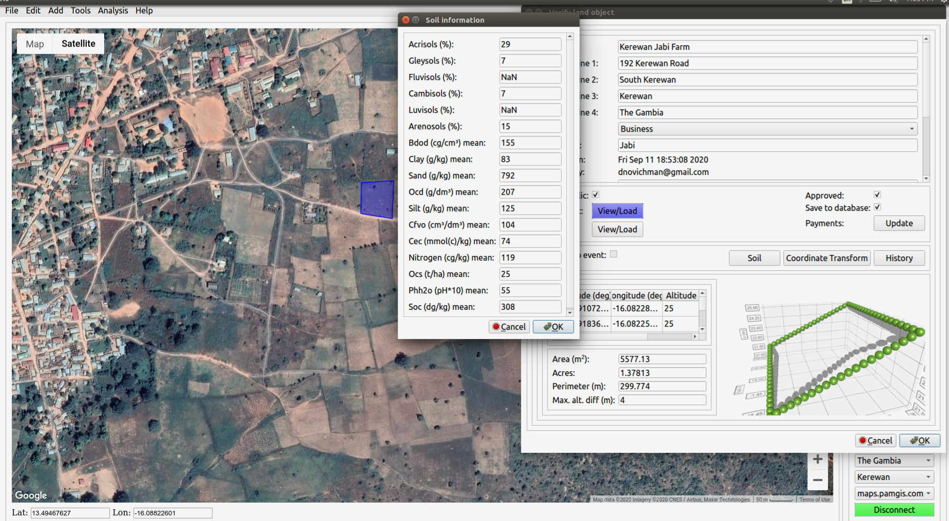
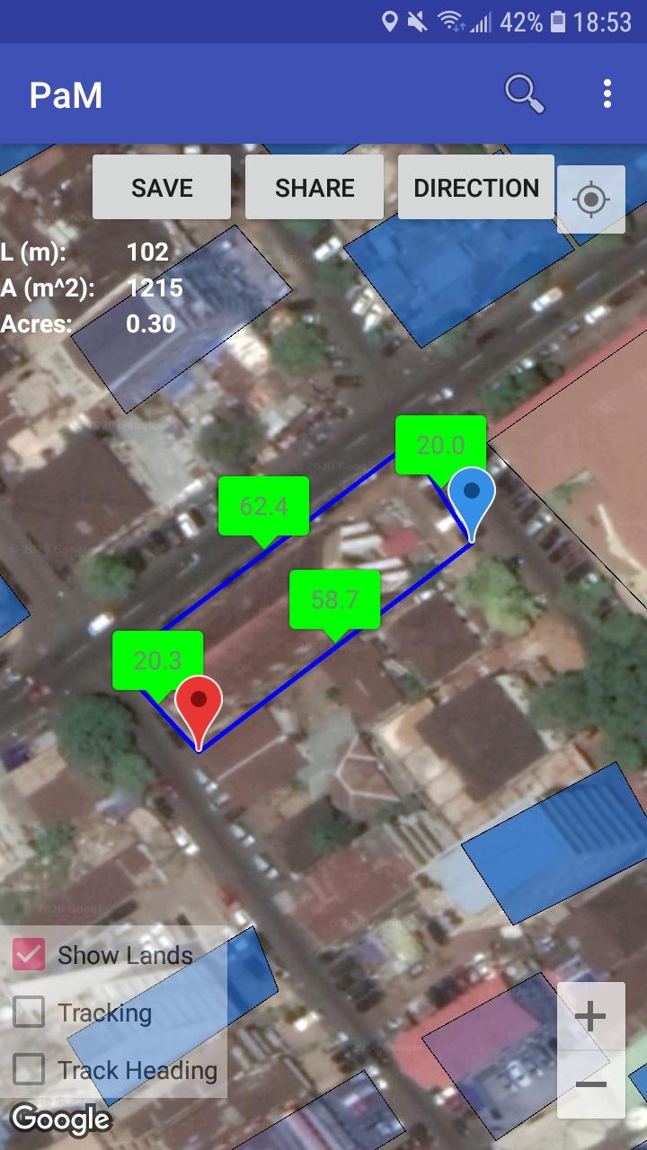
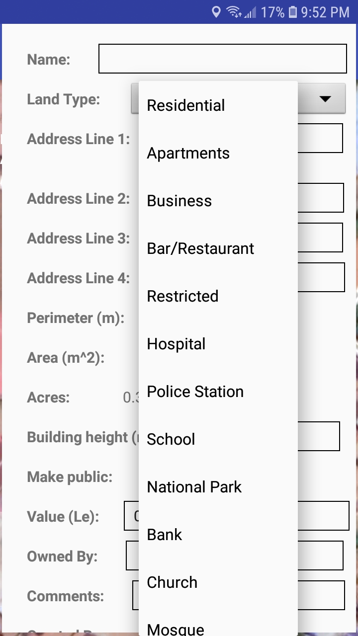
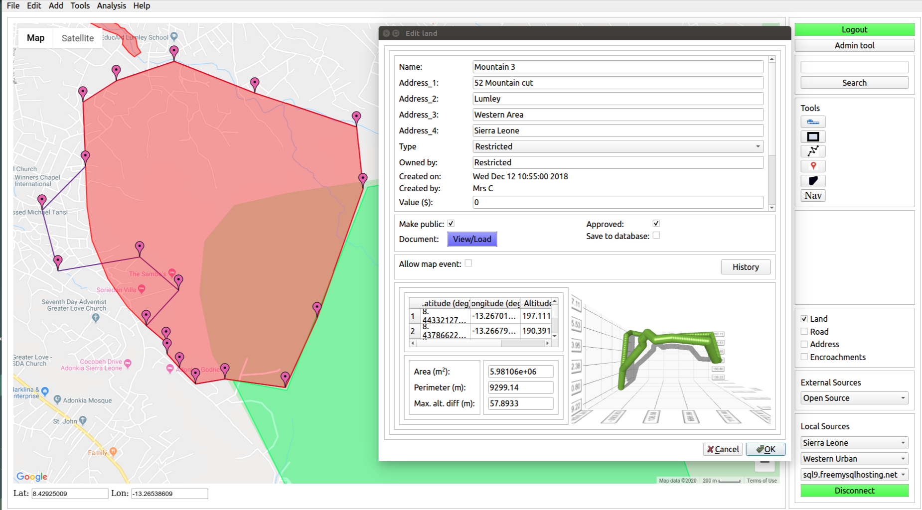
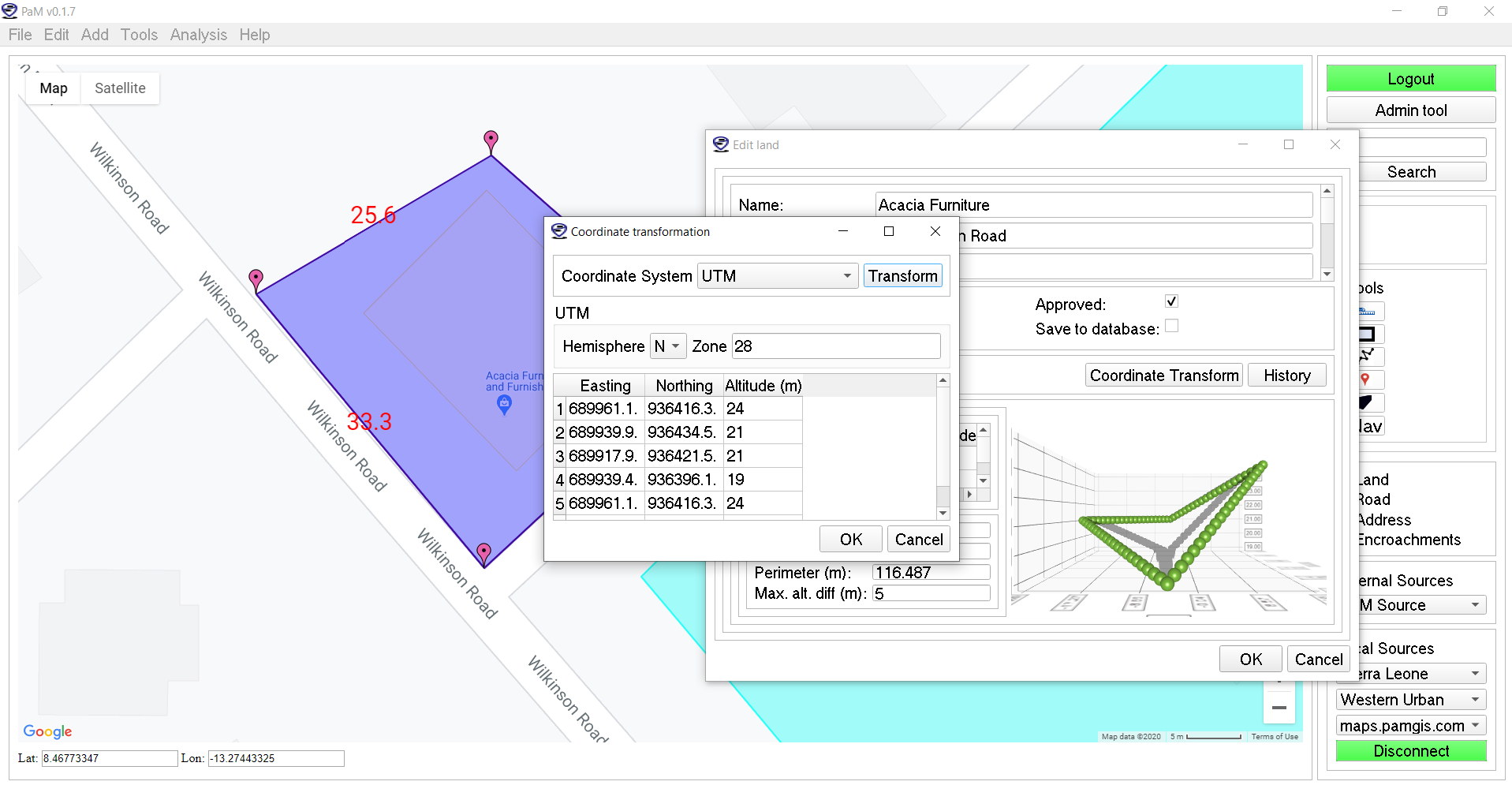
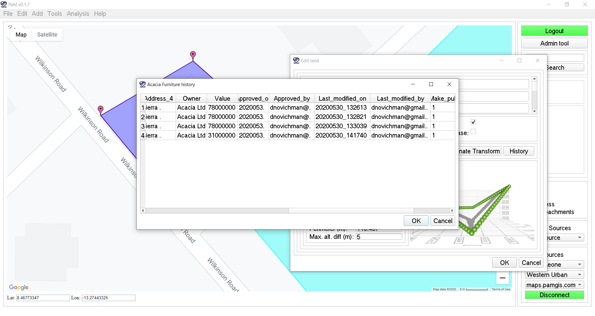
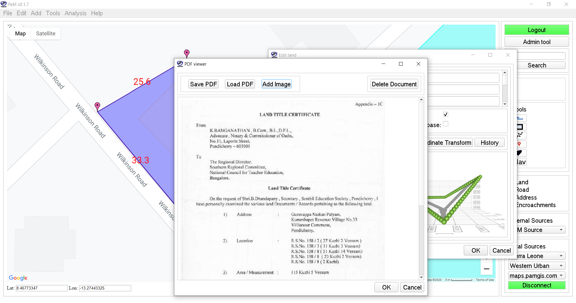
Digital Mapping Our land and road cadastre system tailored for developing countries helps solve the following problems Resolution of land conflicts through single verified land ownership Only people with administrative access (government officials) can approve and/or make changes Historical record of every change Universal digital address using Google Code Land-to-land and land-to-street encroachments Topographical information of every digitalised road and land Realtime visualisation of lands and roads in 3D A surveyor mobile application with realtime spatial measurements Digital records for utilities like poles Every record has associated images and pdf documents Soil information in realtime for every record for agricultural purposes Realtime digitalised addresses, roads and lands. Screenshots Electric pole Soil information on App Soil information for land Digitalisation steps Mobile surveying Survey form Land registration with desktop software. Desktop data input with multiple coordinate system. Historical record of land data. Land title uploader and viewer. Tutorial Videos