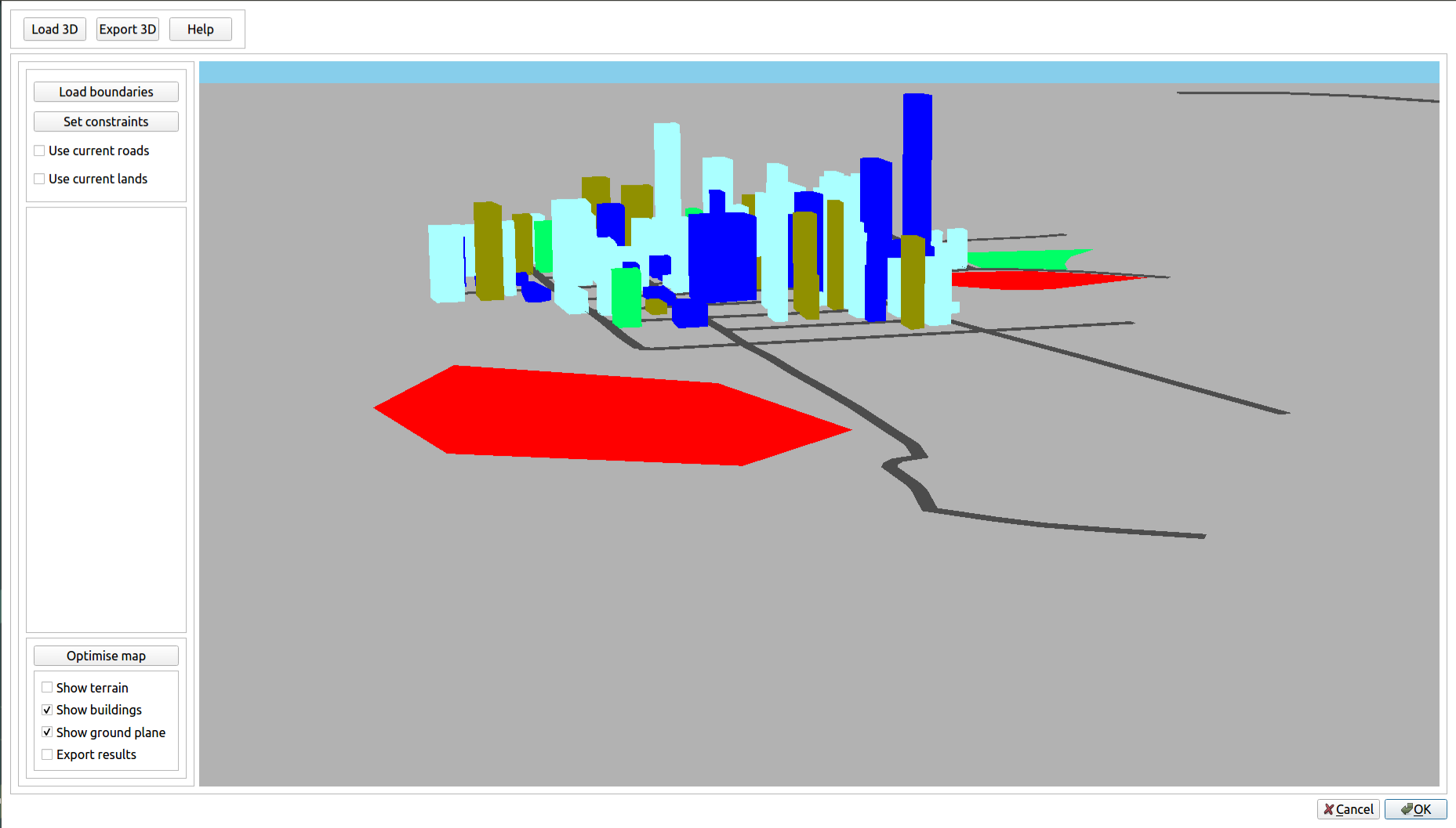
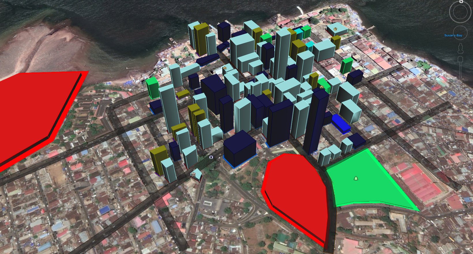
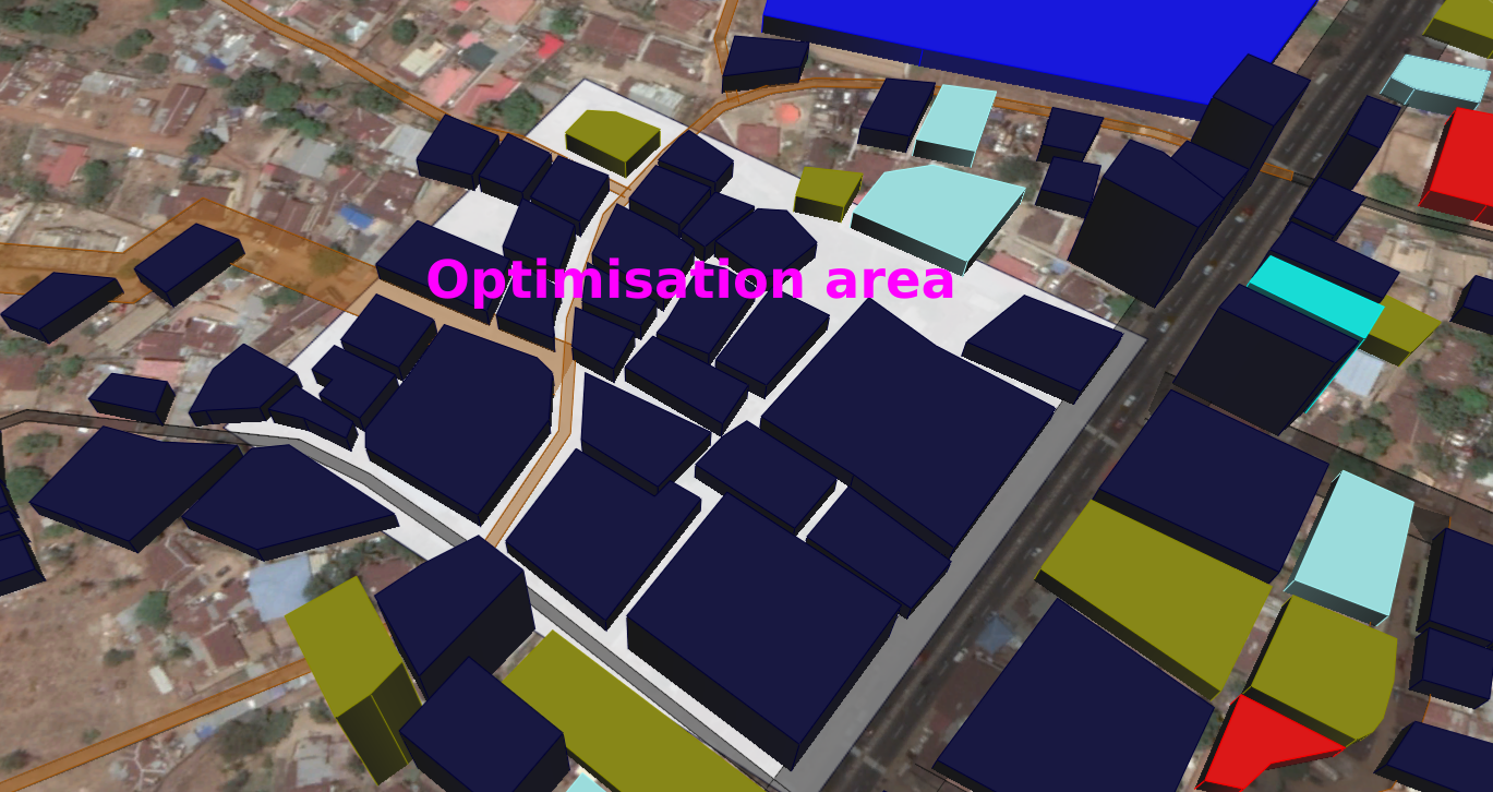
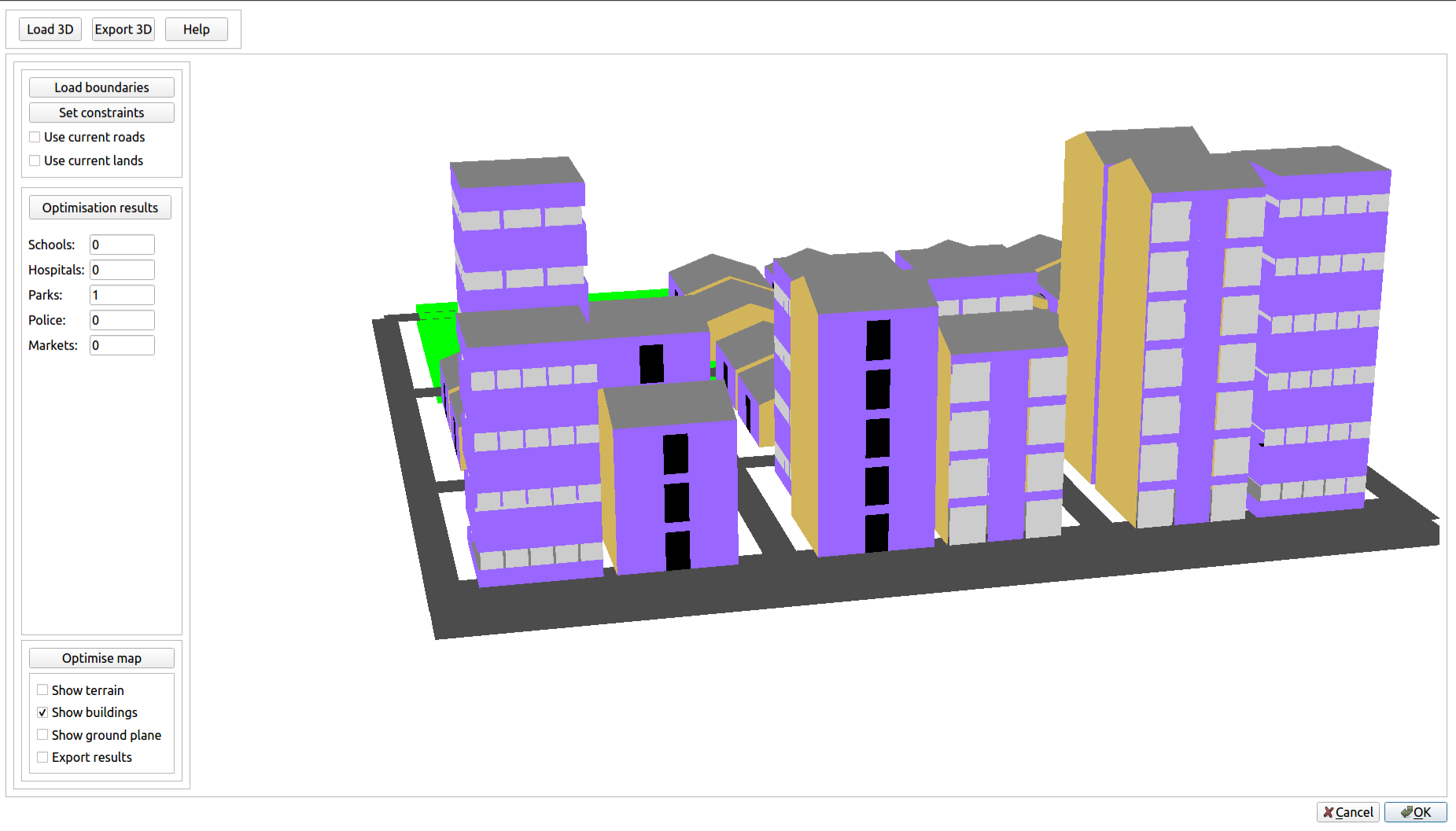
City Planning A novel city planning algorithm for existing and new cities No specialist skills are required to generate 3D scenes for visualisation Can overlay terrain for single and multiple band raster files along with buildings and roads Area of interest for planning/optimisation can be loaded as a KML or entered into a spreadsheet Lots of 3D buildings to choose from with an ever expanding list for visualisation Our novel planning algorithm uses roads, lands and terrain data with desired areas per amenities such as schools, markets, hospitals to output Number of hospitals Number of schools Number of police stations Number of parks/restricted areas Proposed location of land plots and roads Screenshots Visualisation of colour-coded buildings (Freetown CBD, Sierra Leone). 3D buildings exported to Google Earth. Area to be optimised with current buildings shown on Google Earth. 3D viewer showing output of the planner with proposed buildings for residences and businesses. Tutorial Videos