Analytic Tools
Mobile Applications
Our mobile applications have the following analytic tools
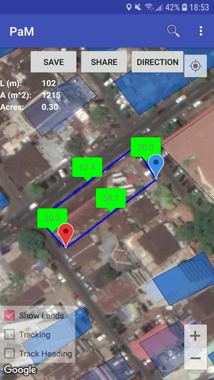
Spatial geometric calculations
For every road or land object that is loaded or created, the dimensions and total perimeter, area and acreage are computed and displayed.
Terrain analysis
3D view of the terrain altitude (in mean sea level - MSL) is available along with difference between the trough and crest to show flatness of the land.
Weather information
Th app provides current and future weather information using the user's current GPS location.
Nearby places analysis
Using the user's current GPS location, details of the total number of important places within a specified radius are provided along with the closest place type. These places include police stations, schools, hospitals.
Tracking analysis
After tracking is turned off, a user's total distance traveled, average and maximum speeds are provided.
Desktop Software
Our desktop software have the following analytic tools
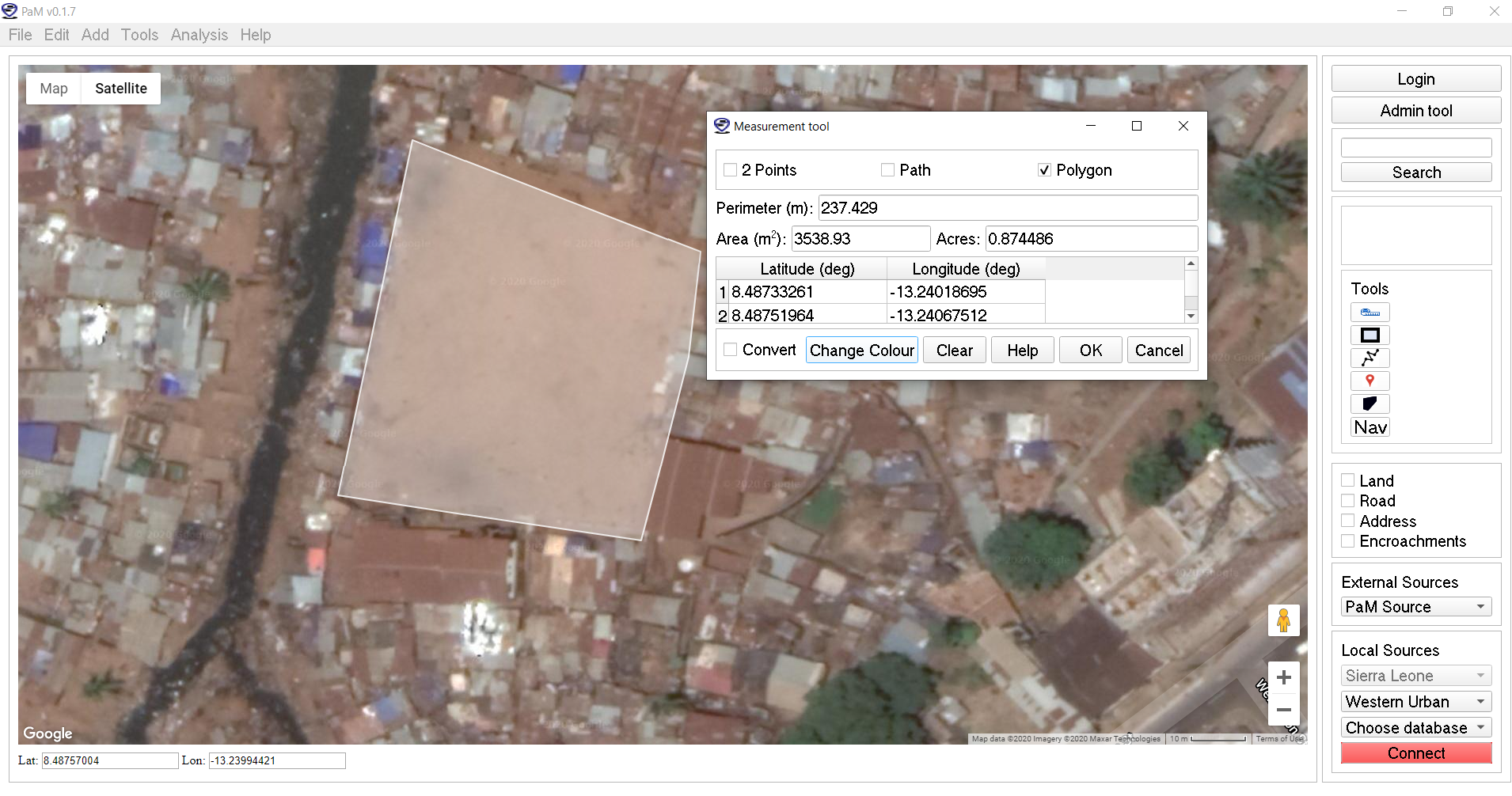
Spatial geometric calculations
In the edit mode of any object, our software provides the spatial dimensions, lengths, perimeter, area and acreage for land and road elements. In addition, the Measurement tool can also provide this for both road and land elements.
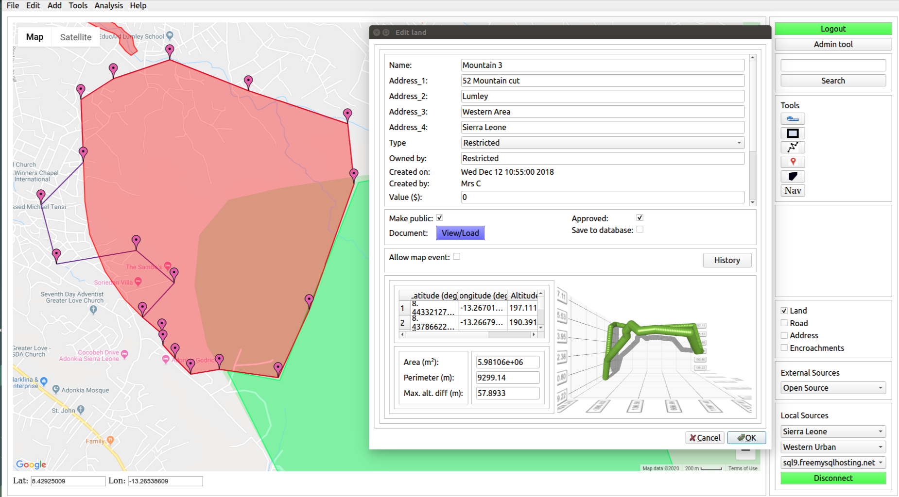
Terrain analysis
3D view of the terrain altitude (in mean sea level - MSL) is available along with altitude difference between the trough and crest to show the flatness of the land
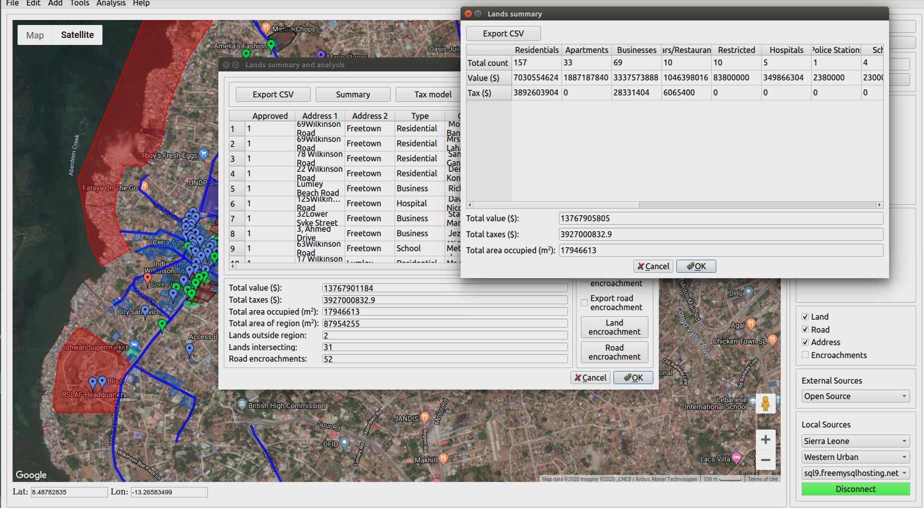
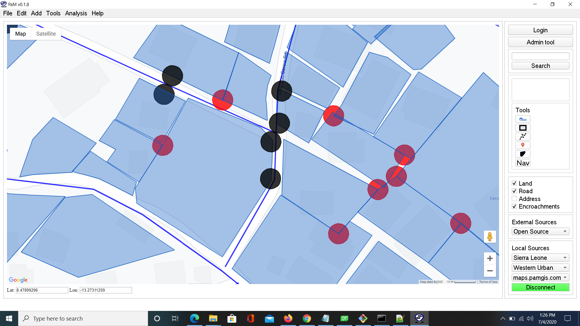
Land and road encroachments
We compute, display and provide a summary of the land-to-land and land-to-road encroachments of all land and road objects in the 2D workspace.
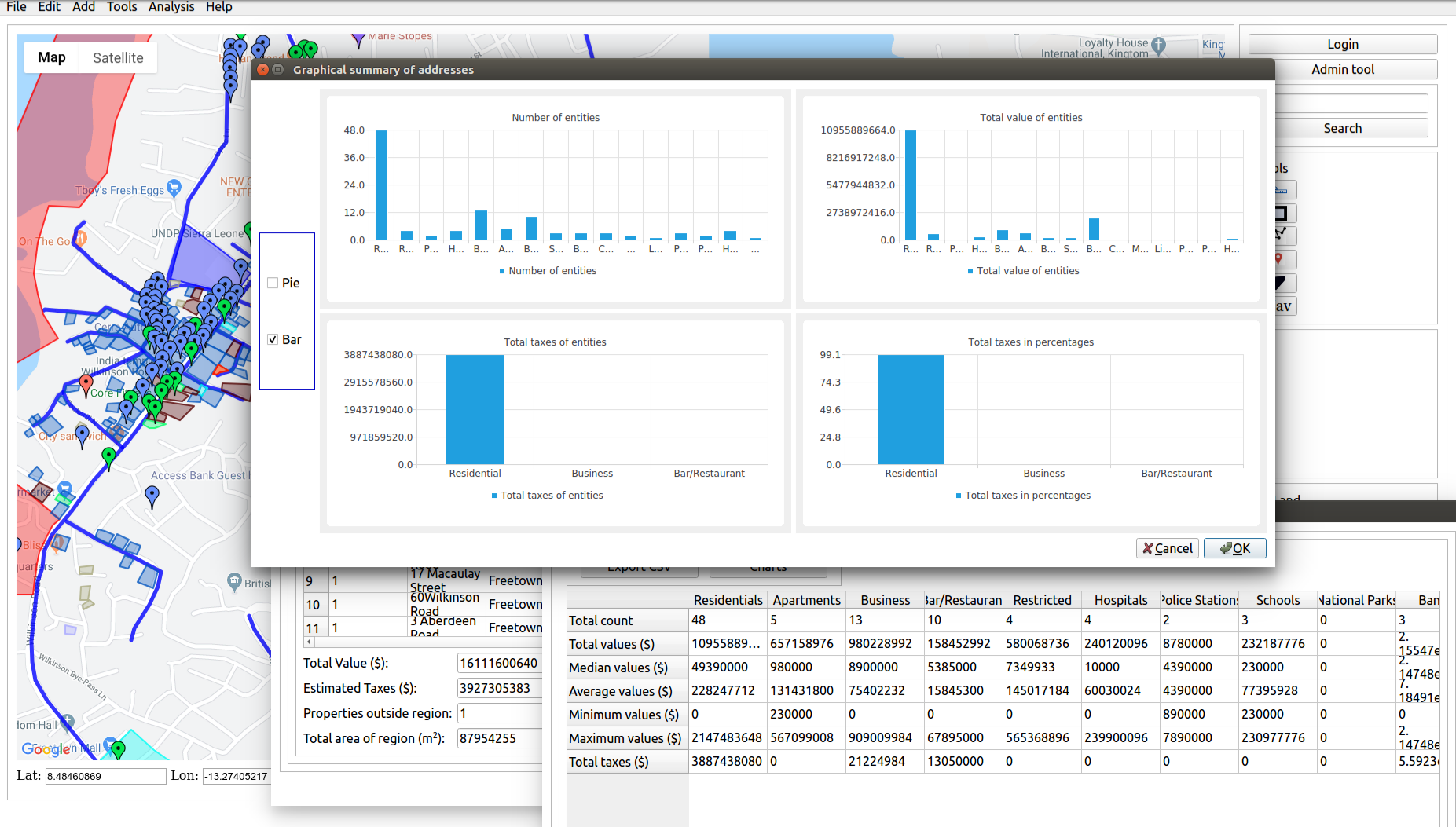
Distribution of spatial data
Bar and pie charts are available to show the percentage distribution of of each data type. For example, percentage of number of lands allocated for schools and percentage of taxes collected from restaurants.
Nearby places analysis
Using an address of GPS coordinates, the software can compute and display the closest and all places of importance that are within a certain radius. using a variety of data sources. These places include police stations, schools, hospitals.
Weather information
Using a GPS location or address, the software provides current and future weather for the specific geo-location.
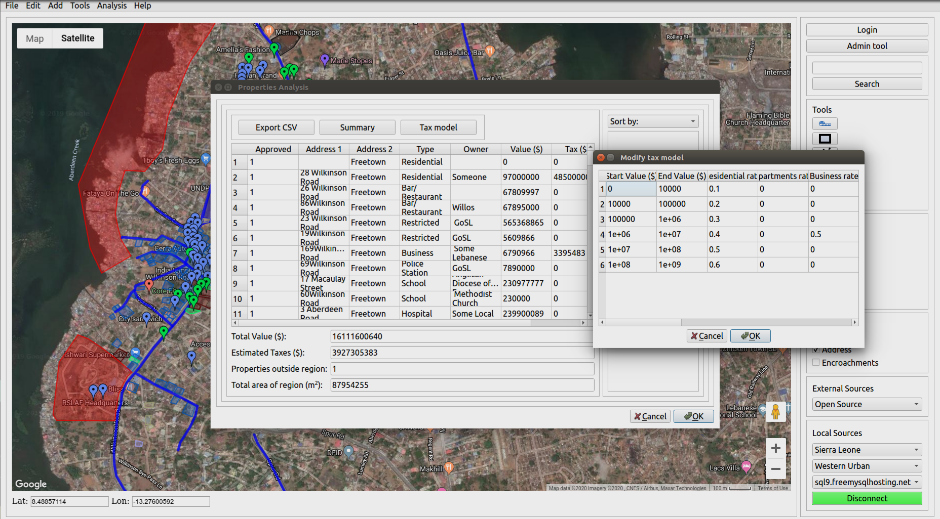
Estimation of taxes for revenue generation
With a user provided tax model, the software provides an estimate of the total taxes that can be collected.
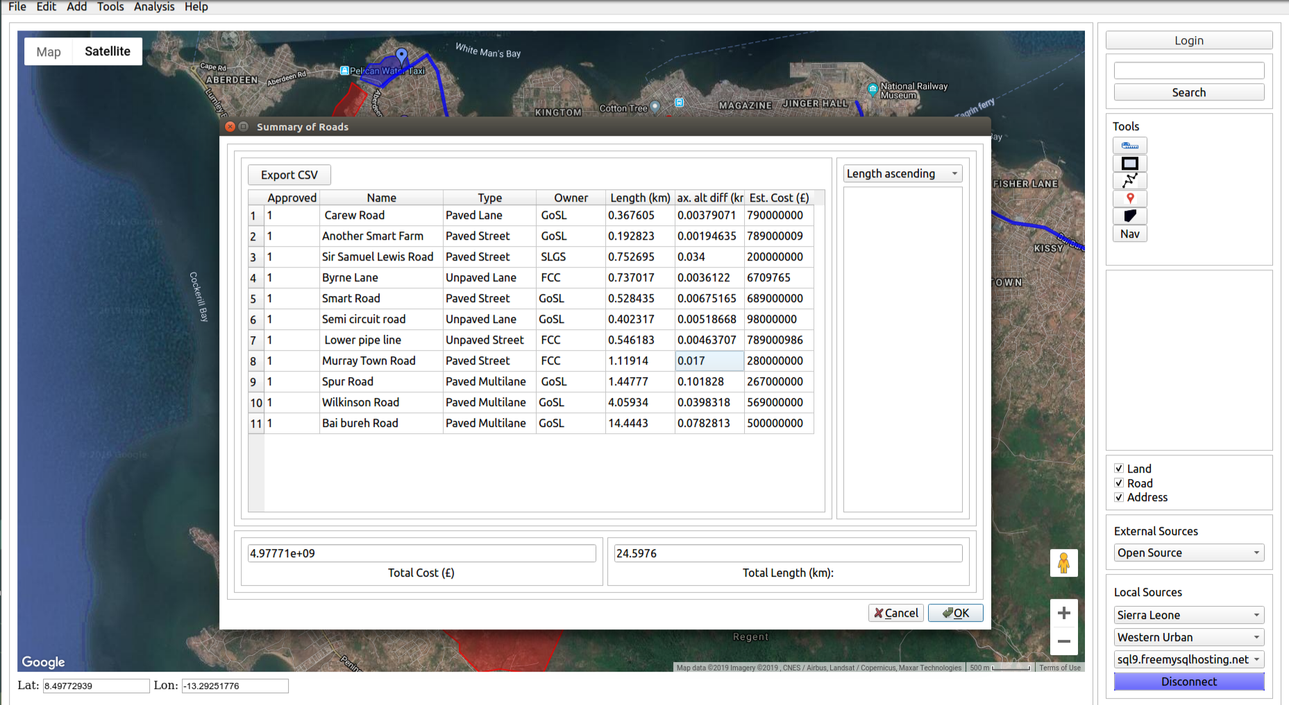
Analysis of roads
The software provides a way of ranking roads. The ranking maybe in terms of length, location, terrain profile etc.